


By Alex Sosnowski, AccuWeather senior meteorologist
“Given the warmth preceding the storm, precipitation will begin as rain in many areas and snow may initially melt on road surfaces throughout the accumulation zone in the Midwest and Northeast,” AccuWeather Storm Warning Meteorologist Joseph Bauer stated.
“How quickly the storm strengthens will determine how quickly cold air can be drawn into the storm, which will have significant implications on how much snow can accumulate,” Bauer explained.
The injection of colder air into the storm, paired with the heavy rate of precipitation anticipated, will allow the storm to overcome the marginal surface temperatures that are in place leading up to its arrival.
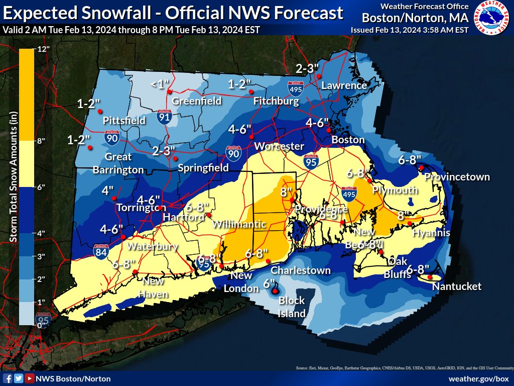
Within the zone where 6-12 inches of snow will fall, there is an AccuWeather Local StormMax™ of 21 inches in the Northeast. The heaviest snow is likely to fall on the higher elevations from northern Pennsylvania and southeastern New York through much of Massachusetts. This band of heaviest snow is also expected to extend through Boston.
“Snowfall rates of 1-2 inches per hour and locally greater can occur for a brief period on Tuesday, where the highest totals are expected,” AccuWeather Meteorologist Adam Sadvary said.
This heavy rate of snow has the potential to strand motorists and inhibit highway departments from keeping roads plowed and open. Road closures are possible at the height of the storm.
Even if the heaviest snow avoids the major Interstate 95 airport hubs of the mid-Atlantic, changing weather conditions and wintry problems with connections from regional flights are likely to trigger substantial delays and cancellations. Delays due to deicing operations will extend far beyond aircraft originating from Boston.